


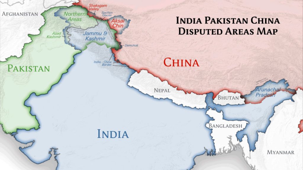
Foreign Report: Asia’s largest country China has released its new ‘standard’ map. In this map published on Monday (August 28), Beijing has shown India’s Arunachal Pradesh as its part.
China calls Arunachal Pradesh South Tibet.
Apart from this, Aksai Chin has also been shown as their share in the new map. Which was captured by Chinese soldiers in the 1962 war.
India’s Foreign Minister S Jaishankar said that China’s new map has no significance and it is an ‘old habit’ of China to claim parts of other countries as its own.
In this regard, Jaishankar told media NDTV on Tuesday, “China has published a map including areas which are not theirs. This is his old habit.
There is no point in adding parts of India to the map. Our government is very clear about which are our territories. With such strange claims, other areas will not become yours.
China not only includes India’s Arunachal Pradesh – the new map shows Taiwan and vast stretches of the disputed South China Sea as part of its territory.
Areas that are reestablishing themselves are Vietnam, the Philippines, Malaysia, and Brunei.
According to Chinese media Global Times, China’s Ministry of Natural Resources unveiled the new map on the Survey and Mapping Release Day.
Global Times published the image of the map on its X (formerly Twitter) account. According to this, the map was made on the basis of China’s cartographic system, the national borders of China, and the borders of other countries.